Tikaboo and “Noname”
On today’s episode (linked above) I start my journey by climbing Tikaboo Peak — the (almost) last legal place where you can actually get your eyes on Area 51. Of course, at a distance of 26 miles away, you need some high powered optics to make anything out which I came well prepared with on this trip.
The climb up Tikaboo was pretty much how it’s been on my previous trips to the summit — nearly 100% grade and covered in loose shale. Once at the top, I opted to pitch my tent just below the summit this time to hopefully avoid the violent wind that kept me awake on my last overnight here. The views were great as usual, though of course always under the watchful eye of the “weather station” (aka the camera with a direct feed to the base.) I did manage to see some F-16s on the runway!
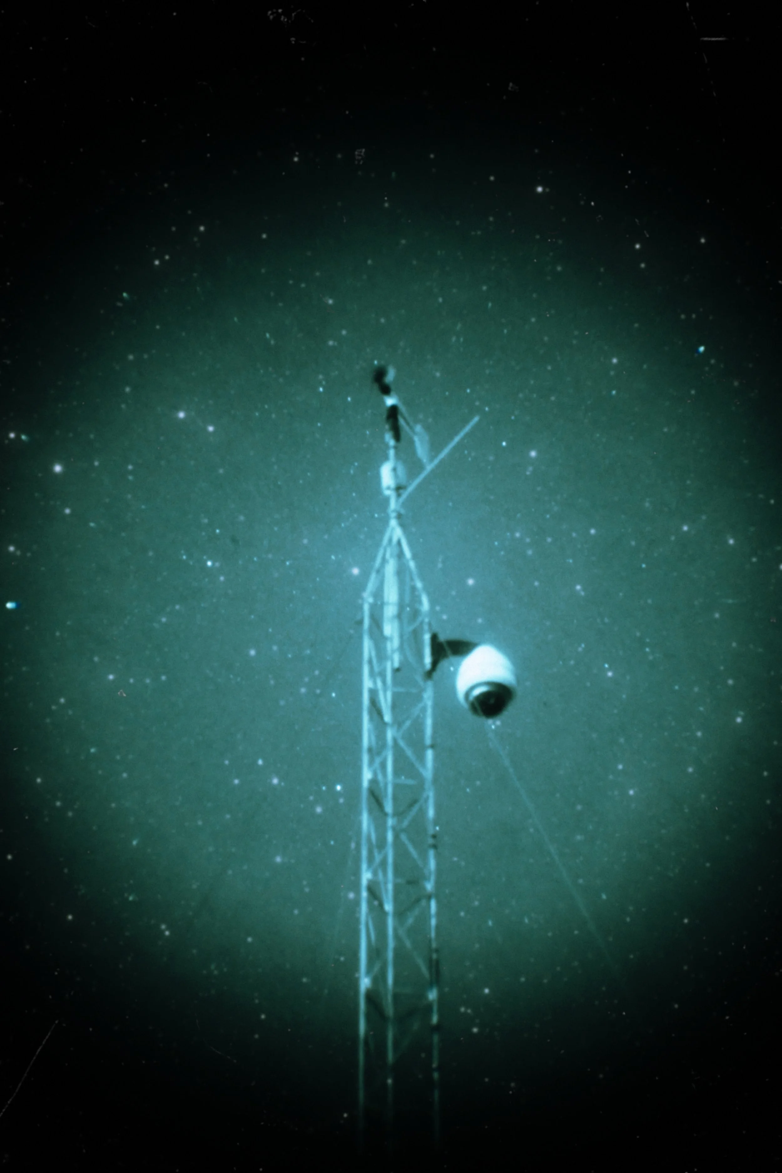
Just a weather station, nothing to see here
The base always knows when someone is on the summit and will delay test flights.

Groom Lake view. This image was made using frame stacking to cut down on the wavy heat lines that are prevalent on hot summer days.

The radar and the triangular tower which is known to rotate on occasion.

At one point a door opened up on this building to reveal a metallic shimmering object glistening in the sun. What could it be? A UFO perhaps?
You’ll recall earlier that I said Tikaboo is ALMOST the last legal place you can view Area 51. Well I wasn’t satisfied with just climbing one peak so the next day I set out for a mysterious little known mountain that also has a view of Dreamland. This obscure peak was first found by Gariac who runs the websites lazygranch.com and inplanesight.org when he did a viewshed analysis of the area. He has dubbed it Noname Peak, so that is what I will be referring to it as. To his and my knowledge, I am the first person to actually climb Noname Peak. The two things this mountain has going for it are the fact that it doesn’t have a camera on top (yet, we’ll see if it stays that way after I publish this video) and you get to see a portion of the base not visible from Tikaboo where the Janets and control tower are located.
I did the climb immediately after doing an overnight on Tikaboo, so while the route was probably not any more difficult, it sure felt like it at the time.
I was mostly able to follow the route from the kml file created by Mr Gariac which I had loaded into Gaia GPS with satellite imagery overlayed. There was a lot of scrambling up loose shale and climbing over sharp boulders (should have worn gloves).
Once I was at the top, there were plenty of flat, level patches for setting up a tripod, bivy tent, etc. which was nice. The top of Tikaboo feels a little cramped in comparison.
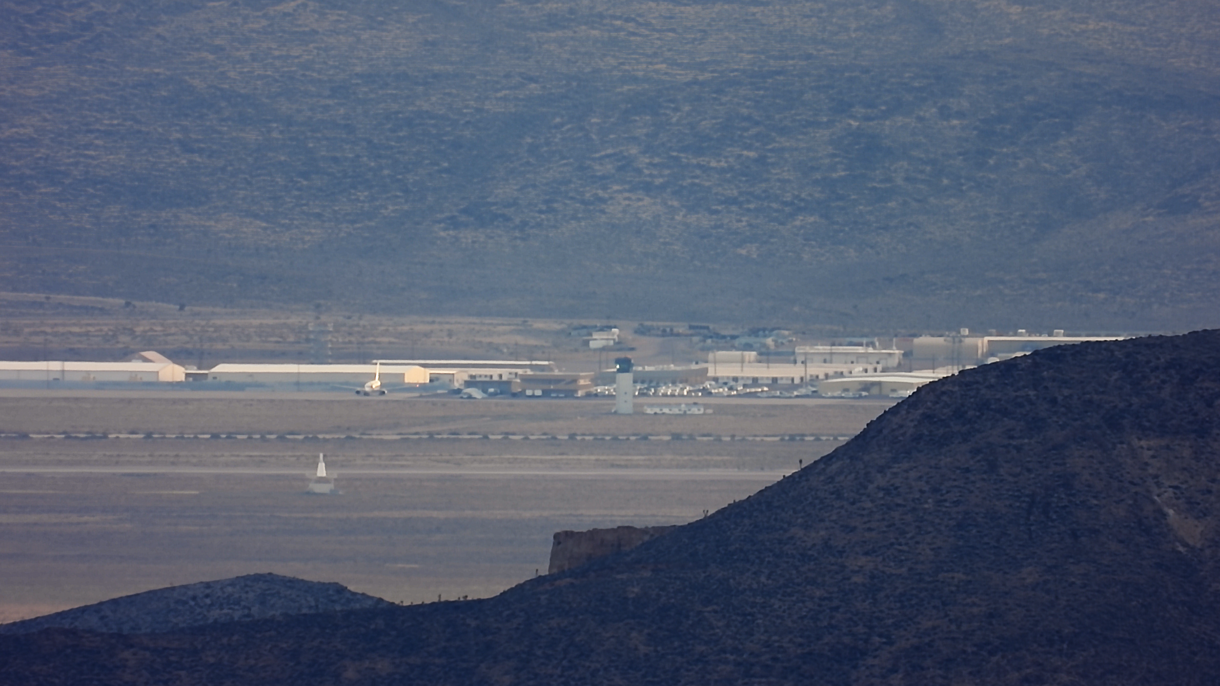
This is an area of the base visible from Noname and not visible from Tikaboo. To my knowledge this is the first time it has been photographed.

A lone Janet sits on the tarmac just after sunset.

I tried some new post processing techniques on this one.
A funny epilogue to the journey, the next day I descended the peak and decided to try a burger from the little hot food counter at the Alamo Sinclair (way better than the Little A'LeInn btw). I was giving the girl at the counter my order when I heard a couple people come in and get in line right behind me. After I paid I turned around to go wait for my order and realized it was 2 camo dudes, and I could see their familiar white Ford parked next to my van in the parking lot. I wonder if they recognized me from all the times I poked around the perimeter?
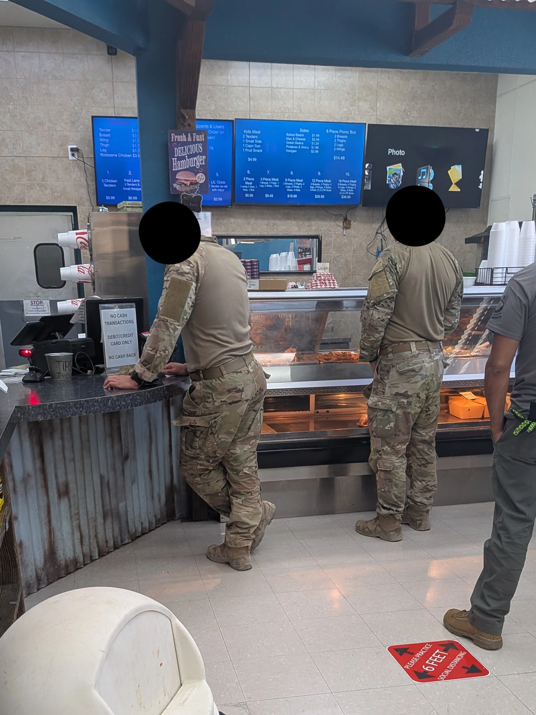
The burgers here were much better than the Little A’Leinn, so I can’t say I blame them.